All signs are pointing to a very busy hurricane season in the Atlantic Ocean.
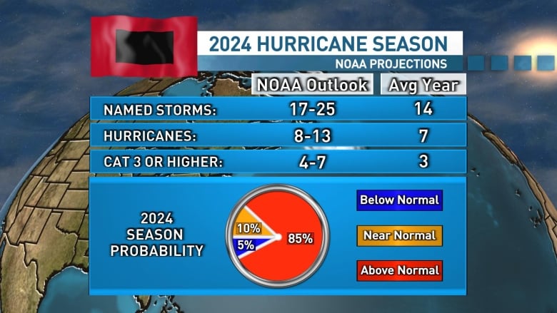
The U.S. National Oceanic and Atmospheric Administration (NOAA) has just released its annual hurricane season forecast and is projecting 17 to 25 storms, the most it has ever forecasted.
Of those storms, eight to 13 are expected to become hurricanes, but it’s still too early to tell if they will hit Atlantic Canada.

NOAA is confident that this will be an active hurricane season, forecasting a 85 per cent chance of an above-normal season, a 10 per cent chance of a normal year and only a five per cent chance of a below-normal activity this season.
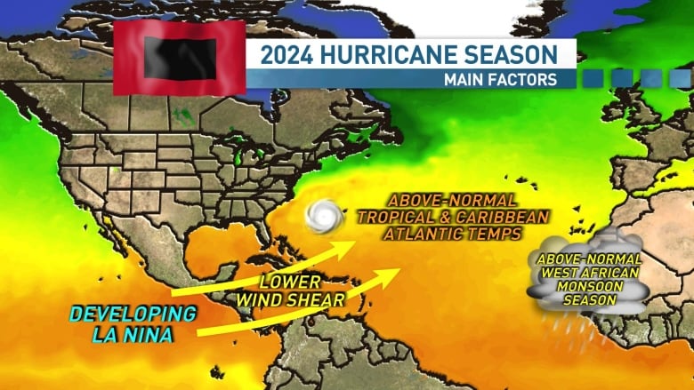
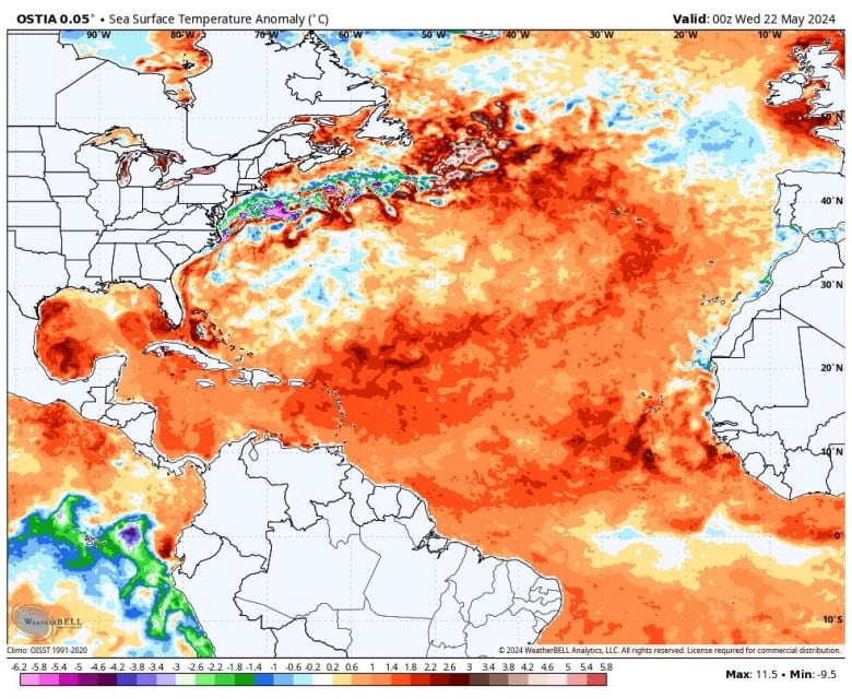
The biggest factor for the upcoming hurricane season is warm sea surface temperatures. Water temperatures in the tropical Atlantic are well above average, right now, with near-record warmth in some areas. This trend is expected to continue throughout the hurricane season.
That warm water is the fuel that tropical storms need to develop and power themselves as they track across the Atlantic and toward North America.

Another large factor for the upcoming season is the expected shift in the Pacific ocean from El Niño to La Niña. This reversal to La Niña would bring a more favourable setup for tropical development in the Atlantic ocean with weaker upper level winds.
Strong upper level winds in the tropical Atlantic can help to shear developing tropical storms and hurricanes apart. So in a La Niña scenario, the atmospheric setup will be more favourable for tropical storms.

Atlantic Canada impacts
It’s important to note that just because the Atlantic will be active, it doesn’t necessarily mean it will be a busy tropical season for us here in Atlantic Canada.
The most active Atlantic Hurricane season on record was 2020 when there were 30 named storms. However, the only storm to impact the region was post-tropical storm Teddy, which made an impact, but thankfully was not too damaging.
So while a high number of storms will increase the overall chances of storms here, it’s far from a guarantee.
The number of storms that end up tracking into our region will all depend on the atmospheric setup across the Atlantic Ocean and North America when the tropical storms develop and are on approach.

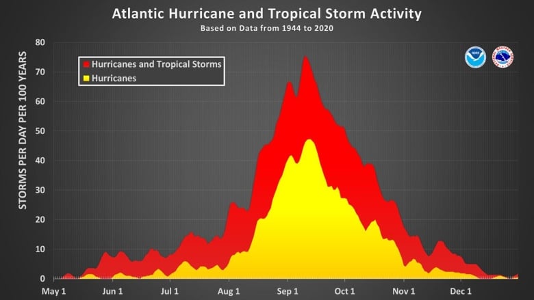
While hurricane season runs from June 1 to Nov. 30, historically most of the activity and our best chances of seeing impacts here are from late summer into early fall.
MORE TOP STORIES


